


Voting District 123, Ada County, Idaho
About
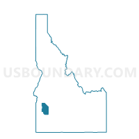
Outline

Summary
| Unique Area Identifier | 563610 |
| Name | Voting District 123 |
| County | Ada County |
| State | Idaho |
| Area (square miles) | 21.20 |
| Land Area (square miles) | 21.10 |
| Water Area (square miles) | 0.10 |
| % of Land Area | 99.54 |
| % of Water Area | 0.46 |
| Latitude of the Internal Point | 43.45198270 |
| Longtitude of the Internal Point | -116.45024940 |
Maps


Graphs
Select a template below for downloading or customizing gragh for Voting District 123, Ada County, Idaho


Neighbors
Neighoring Voting District (by Name) Neighboring Voting District on the Map
- Voting District 027003, Canyon County, ID
- Voting District 027028, Canyon County, ID
- Voting District 117, Ada County, ID
- Voting District 122, Ada County, ID
- Voting District 124, Ada County, ID
- Voting District 125, Ada County, ID
- Voting District 141, Ada County, ID
Top 10 Neighboring County Subdivision (by Population) Neighboring County Subdivision on the Map
- Nampa CCD, Canyon County, ID (119,851)
- Orchard CCD, Ada County, ID (19,106)
- Kuna CCD, Ada County, ID (18,941)
- Melba CCD, Canyon County, ID (2,408)
Top 10 Neighboring Place (by Population) Neighboring Place on the Map
Top 10 Neighboring Unified School District (by Population) Neighboring Unified School District on the Map
Top 10 Neighboring State Legislative District Lower Chamber (by Population) Neighboring State Legislative District Lower Chamber on the Map
Top 10 Neighboring State Legislative District Upper Chamber (by Population) Neighboring State Legislative District Upper Chamber on the Map
Top 10 Neighboring 111th Congressional District (by Population) Neighboring 111th Congressional District on the Map
Top 10 Neighboring Census Tract (by Population) Neighboring Census Tract on the Map
- Census Tract 104.01, Ada County, ID (18,941)
- Census Tract 105.01, Ada County, ID (7,467)
- Census Tract 223, Canyon County, ID (6,215)
- Census Tract 224, Canyon County, ID (4,472)